
AAI Executive Director Jason Martin
crossing the bergshrund on Huayna Potosi in 2003.
Photo by Phil Highfill
Though La Paz maybe isn't one of the top climbing towns in South America, it sits right at the foot of the Andes Mountains, and it has access to some of the best alpine climbs in the world, such as Ancohuma and Illampu, Illimani, and of course, Huayna Potosi. Without a doubt, Huayna Potosi is the most popular of these destinations, and it is, by many, considered to be the “easiest” of the 6000+ meter peaks in the world.
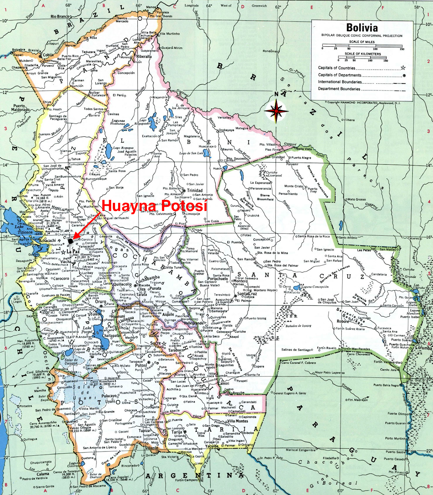
Map Of Bolivia
The French Alpine system gives the Normal Route a grade of “PD” (though some sources give it a AD-) due to a few sections of exposed ridges and moderately steep glaciers with crevasses. However, whether or not it is the “easiest” 6000m peak is a debatable statement, as there are other mountains of similar altitude which have a equal or slightly lower difficulty grade.
Huayna Potosi is, however, one of the most accessible 6000+ meter peaks in the world. You can arrive at the base of the mountain by car, and it has two base camps that you can use to assist your climb. Furthermore, the second base camp is located at an altitude of 5130m, only about 1000m lower than the summit. The nearby city of La Paz itself sits at 3640m, making acclimatization, gathering supplies, and obtaining other amenities relatively easy.
Normal Route
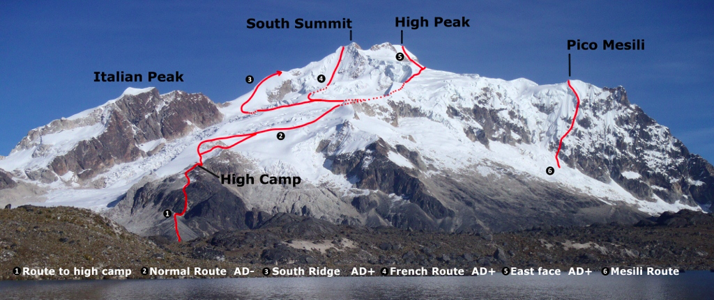
There are a handful of established routes to reach the summit. But the least technical and by far the the most popular is the Normal Route.
Advantages of Climbing the Normal Route

The Normal Route was first climbed in 1919 by Rudolf Dienst and Adolf Schulze. Since then it has been climbed by thousands, and in the peak season (May-September) it sees regular summits.
This route can usually be climbed with relatively minimal alpine skills -- especially if you access the route with a guide -- and it only has a few exposed sections near the top. In addition, the standard high camp (Campo Alto) is located about 1000 vertical meters from the summit, meaning that you can reach the summit and then return back to camp in one push relatively easily, depending on climbers’ fitness levels and acclimatization.
However, “easy” should not be be confused with “safe”. Alpine climbing is inherently dangerous, and there have been many deaths over the years by climbers attempting to summit. Now-a-days, incidents are uncommon, but it is still highly advisable to go with a guide, especially if you are an inexperienced high-altitude alpine climber.
The Normal Route has a relatively straightforward approach. In addition, there are two base camps on the way where you can stay the night and buy very basic supplies (food, water, etc…).
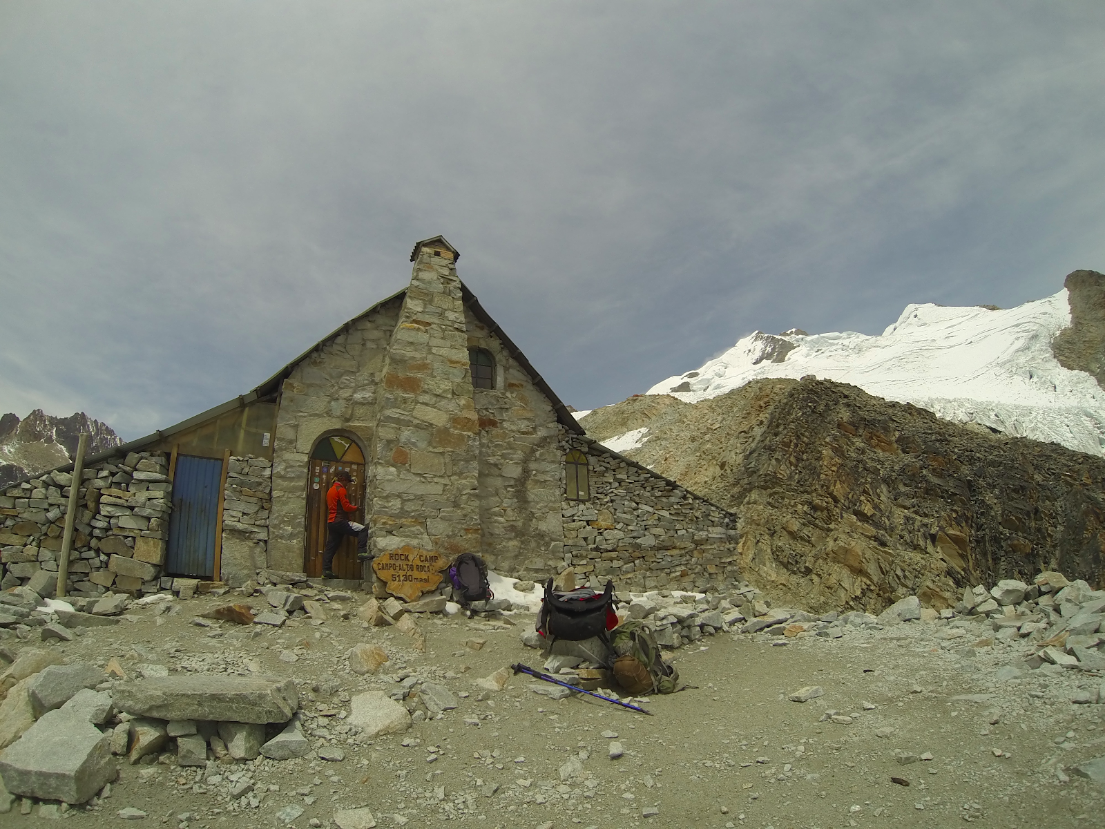
The lower base camp, called “Refugio Casa Blanca” can be accessed by taxi directly from La Paz. From here you can spend a day or two acclimatize and explore the beautiful surroundings. Once ready, the second base camp, called “Campo Alto” is located after a relatively steep two hour hike on a very well marked trail. From this camp you will be able to make the ascent toward the summit.
For our ascent, we first arrived at the lower base camp to acclimatize for an extra day. We explored some of the surrounding lakes, and even went out for a few quick rock climbs at the nearby Zongo Pass area.
After spending the night at the refugio, we woke early, and headed up the well marked trail to the high camp. Here we took the opportunity to practice glacier navigation and ice anchor construction. After spending the second day out exploring, we returned back the high base camp to prepare our packs for that evening’s assent.
If you have a good weather window, most groups will start their ascent between 11pm and 2am, and will climb through the night in order to reach the summit near sunrise (around 6am). From here you will experience stunning views of the surrounding Andean peaks, an experience which few will ever get to live themselves.
It is advisable to reach the summit near dawn, as the intense South American sun quickly softens the glacier, not only making walking more dangerous, but it also increases avalanche danger and causes consistent rock fall.
The summit itself is a large glaciated ridge. Here you will have excellent views of the surrounding mountains, and will even be able to see the glow of nearby La Paz. For the descent, you simply follow the path you took, taking extra care on the steepest part of the descent.
Once arriving at Camp Alto, most groups continue down to base camp as soon as possible, especially if any party members are experiencing symptoms of altitude sickness. Though the time of ascent can vary dramtically, most groups will be able to make it to the summit and return back to the first basecamp in 8 to 12 hours.
Huayna Potosi is excellent intro to high altitude climbing. It requires a mix of glacier travel and crevasse navigation skills, and it is a good place test yourself at 6000m. After successfully completing Huayna Potosi, many climbers return to La Paz, rest a few days, and then go off to enjoy some of the other climbing near the city, or take their new skills and acclimatization to attempt higher and more difficult mountains nearby such as Illimani or Ancohuma and Illampu.
--Jacob Bushmaker: Avid Climber, Professional Traveler and Founder of The Wandering Climber. He has climbed in over 20 countries across 4 continents, and is an expert on South American climbing destinations. (Go here now and get tons of information on where he’s been, and plan your next journey).
From http://www.boliviaclimbinginfo.org/
Click to Enlarge
Advantages of Climbing the Normal Route
- Easy access, as the first base camp can be reached by car, and the second with a straightforward 2-hour hike
- The route isn’t highly technical (PD/AD- grade), meaning the barriers of entry regarding cost, gear, and skills required are lower when compared to many peaks at this altitude. Conditions are always at play though, and occasionally there are pitches of steep ice on the route.
- This route is highly traveled, and for that reason, it is easy to find information on the route and it's current conditions
- It avoids some of the complexity and danger compared to other routes on the mountain such as the West Face
A topo of commonly climbed routes on Huayna Potosi can be seen here.
Click to Enlarge
The Normal Route was first climbed in 1919 by Rudolf Dienst and Adolf Schulze. Since then it has been climbed by thousands, and in the peak season (May-September) it sees regular summits.
This route can usually be climbed with relatively minimal alpine skills -- especially if you access the route with a guide -- and it only has a few exposed sections near the top. In addition, the standard high camp (Campo Alto) is located about 1000 vertical meters from the summit, meaning that you can reach the summit and then return back to camp in one push relatively easily, depending on climbers’ fitness levels and acclimatization.
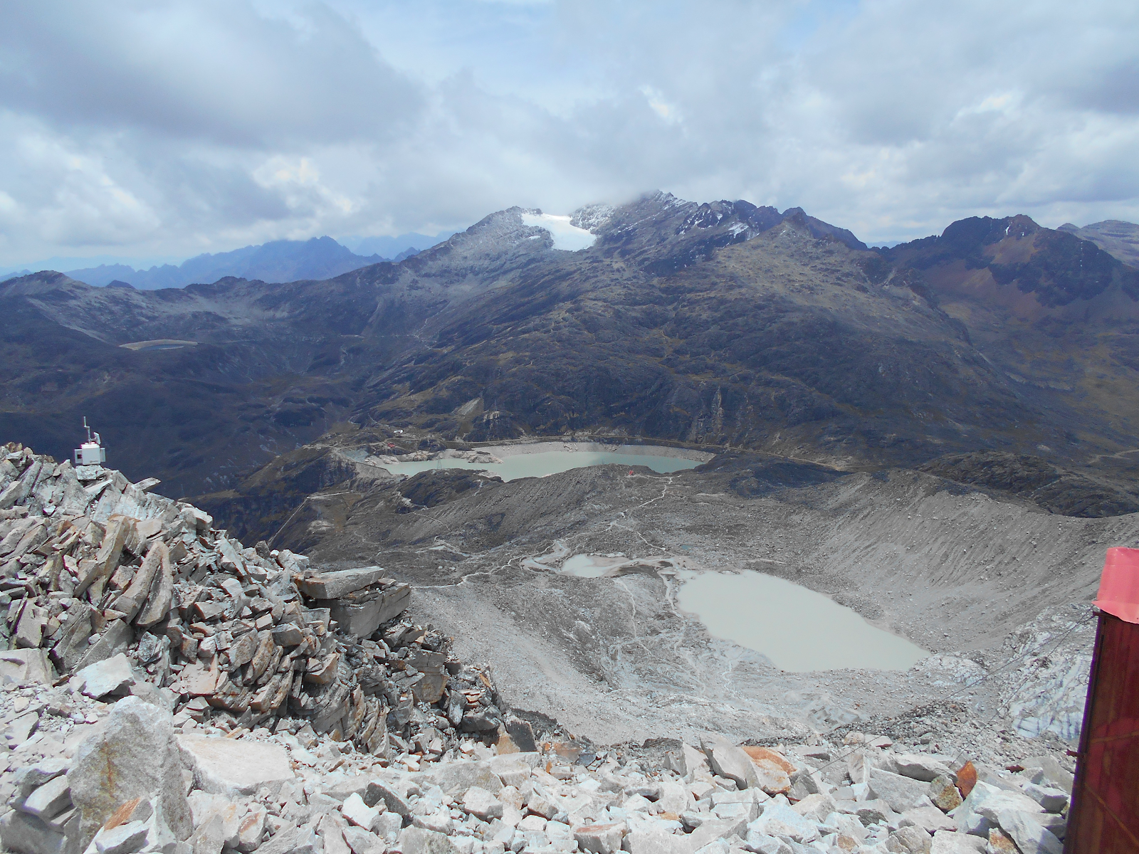
Campo Alto at the foot of the Zongo Glacier
However, “easy” should not be be confused with “safe”. Alpine climbing is inherently dangerous, and there have been many deaths over the years by climbers attempting to summit. Now-a-days, incidents are uncommon, but it is still highly advisable to go with a guide, especially if you are an inexperienced high-altitude alpine climber.
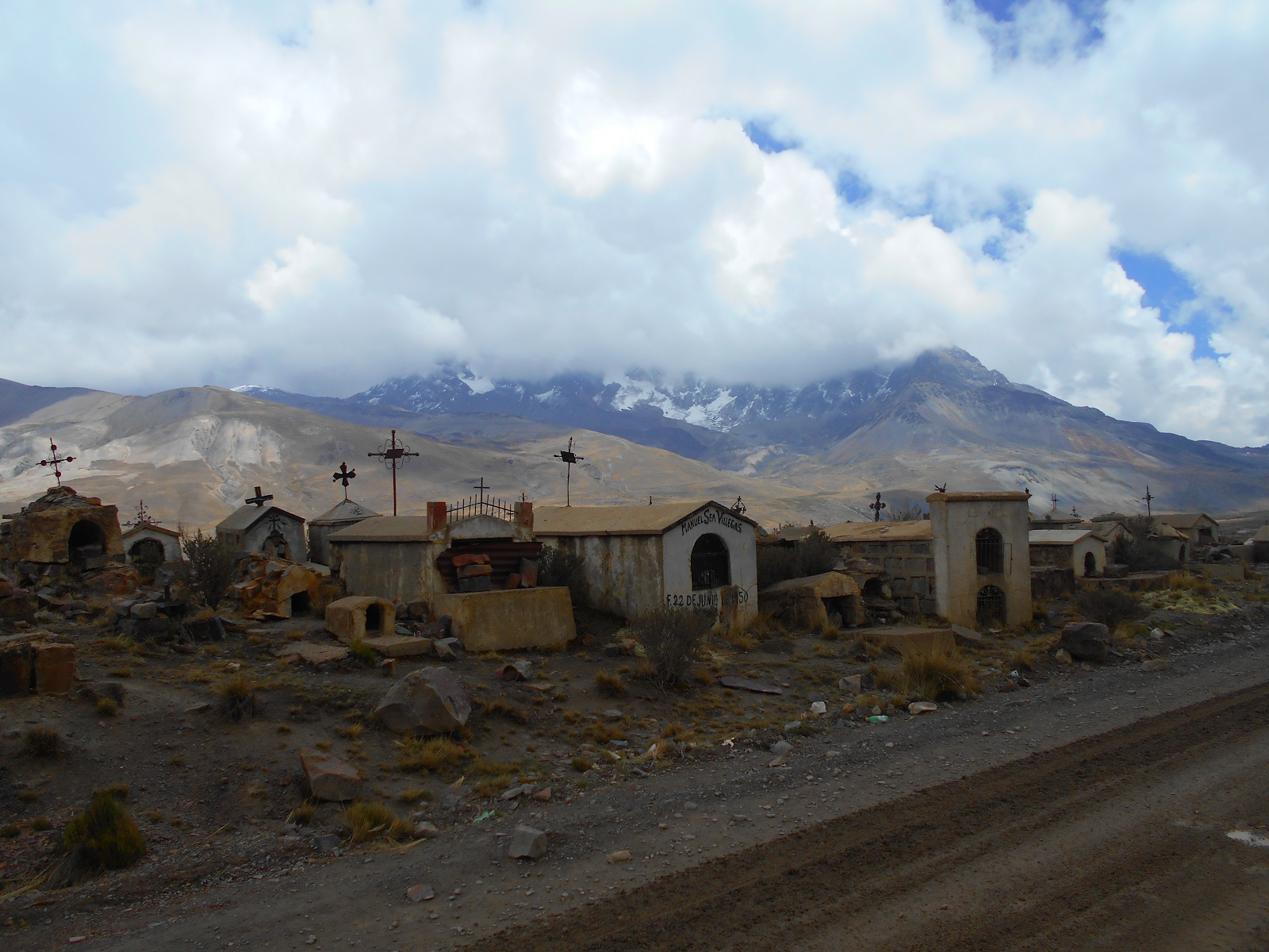
A Cemetery At Huayna Potosi’s Base
The Normal Route has a relatively straightforward approach. In addition, there are two base camps on the way where you can stay the night and buy very basic supplies (food, water, etc…).
The lower base camp, called “Refugio Casa Blanca” can be accessed by taxi directly from La Paz. From here you can spend a day or two acclimatize and explore the beautiful surroundings. Once ready, the second base camp, called “Campo Alto” is located after a relatively steep two hour hike on a very well marked trail. From this camp you will be able to make the ascent toward the summit.
A View of Zongo Pass Seen From Camp Alto
For our ascent, we first arrived at the lower base camp to acclimatize for an extra day. We explored some of the surrounding lakes, and even went out for a few quick rock climbs at the nearby Zongo Pass area.
After spending the night at the refugio, we woke early, and headed up the well marked trail to the high camp. Here we took the opportunity to practice glacier navigation and ice anchor construction. After spending the second day out exploring, we returned back the high base camp to prepare our packs for that evening’s assent.
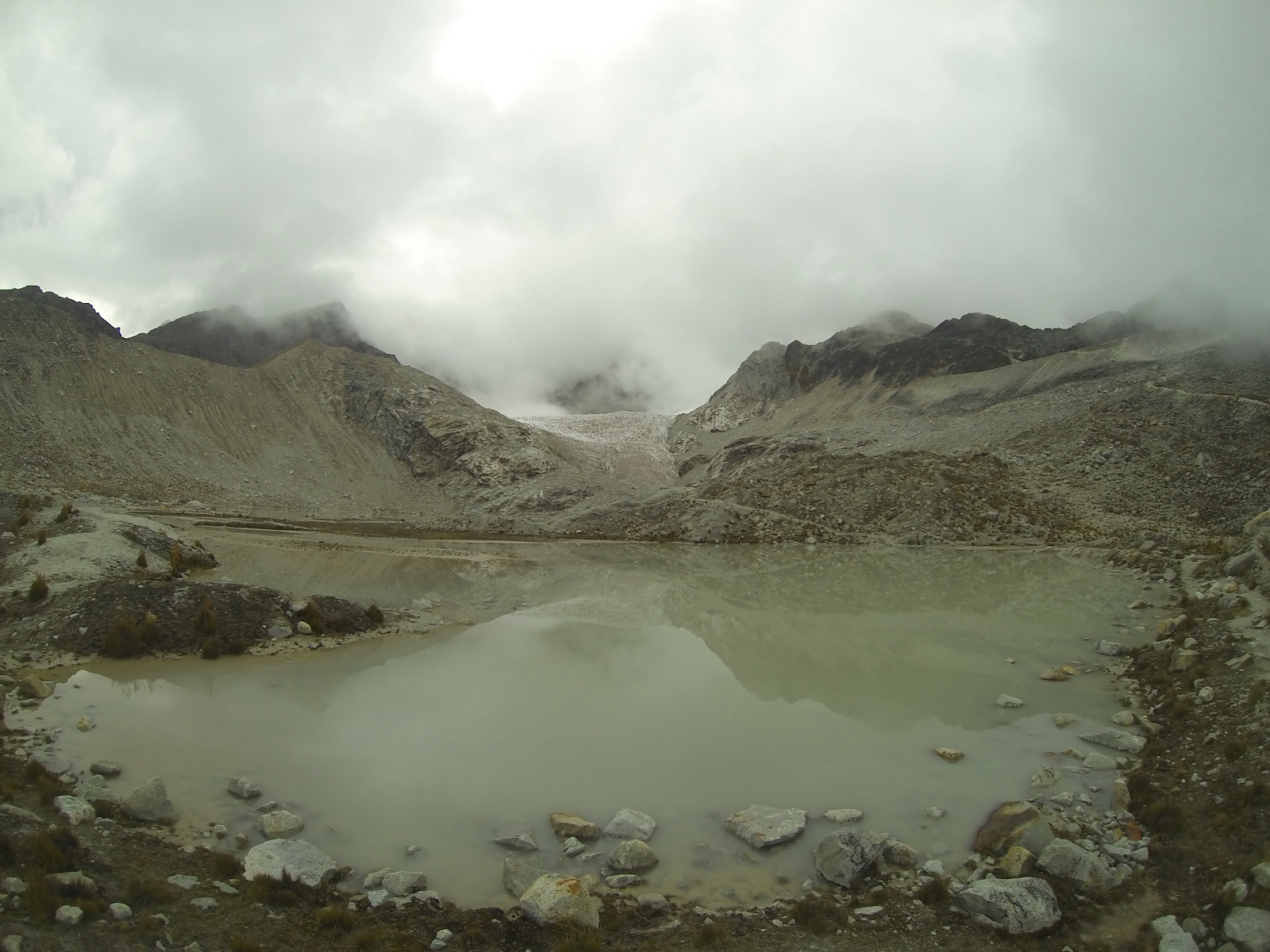
Laguna Milluni
We explored this area while preparing for our ascent.
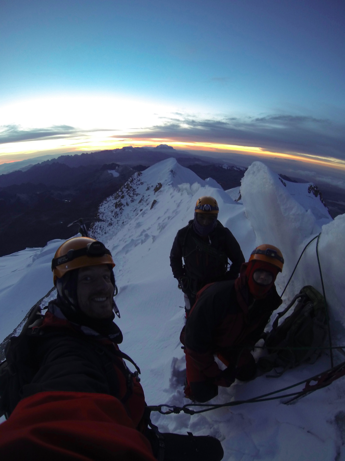
If you have a good weather window, most groups will start their ascent between 11pm and 2am, and will climb through the night in order to reach the summit near sunrise (around 6am). From here you will experience stunning views of the surrounding Andean peaks, an experience which few will ever get to live themselves.
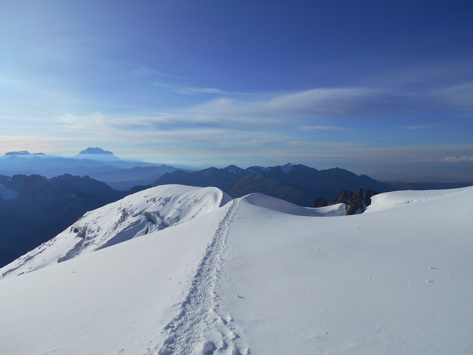
The Summit
It is advisable to reach the summit near dawn, as the intense South American sun quickly softens the glacier, not only making walking more dangerous, but it also increases avalanche danger and causes consistent rock fall.
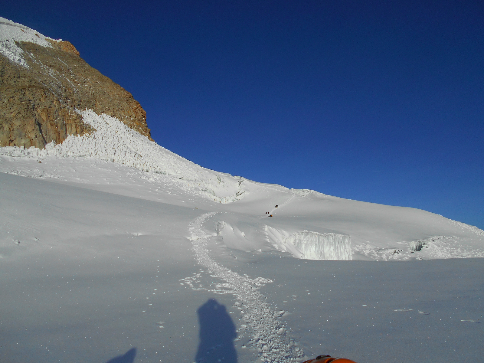
The route itself is flat for about the first 4 or so hours. There are a number of crevasses that you must cross, which means that glacier navigation and rescue knowledge is essential. The end of the route is by far the most difficult, as it has about one hour of steep climbing up a sometimes exposed ridge.
A Few Parties Descending After Reaching the Summit
The summit itself is a large glaciated ridge. Here you will have excellent views of the surrounding mountains, and will even be able to see the glow of nearby La Paz. For the descent, you simply follow the path you took, taking extra care on the steepest part of the descent.
Once arriving at Camp Alto, most groups continue down to base camp as soon as possible, especially if any party members are experiencing symptoms of altitude sickness. Though the time of ascent can vary dramtically, most groups will be able to make it to the summit and return back to the first basecamp in 8 to 12 hours.
Returning to Campo Alto
Huayna Potosi is excellent intro to high altitude climbing. It requires a mix of glacier travel and crevasse navigation skills, and it is a good place test yourself at 6000m. After successfully completing Huayna Potosi, many climbers return to La Paz, rest a few days, and then go off to enjoy some of the other climbing near the city, or take their new skills and acclimatization to attempt higher and more difficult mountains nearby such as Illimani or Ancohuma and Illampu.


No comments:
Post a Comment